Google has rolled back its new AI tool that allowed people to create fake images on top of its satellite imagery, following a BBC Verify report in which experts raised concerns about misuse and the potential to spread misinformation.
Less than 48 hours after the tech giant announced the integration of its AI image generator Nano Banana 2 into Google Earth, it said it was pausing the feature, external "while we work on implementing stronger guardrails".
In its statement on Friday, Google said it had seen "people sharing screenshots of generated imagery that appear to violate our policies".
The retracted feature enabled users to use text prompts to generate false scenarios on top of a base layer of real satellite, aerial or 3D imagery - which could then be downloaded and shared on other platforms.
"We know that people uniquely trust Google Earth for a reliable view of the world," it added.
Experts told BBC Verify the tool could be used to spread misinformation with the appearance of Google's legitimacy - and highlighted the potential for bad actors to abuse it.
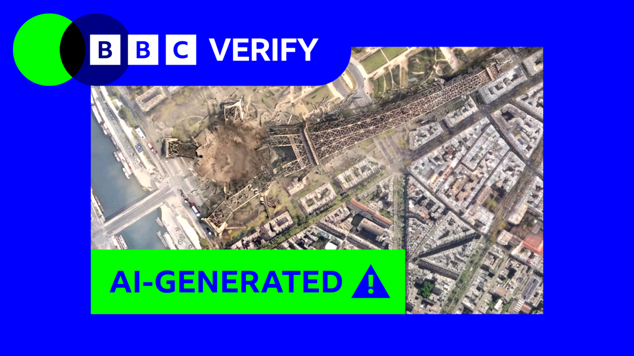
A collapsed Eiffel Tower, a sinkhole swallowing the Great Pyramid of Giza and Russian tanks in Ukraine's capital were among the images BBC Verify was able to create when testing the feature, which initially launched on Thursday.
Before it was paused, AI and misinformation expert Henk van Ess highlighted the risks the feature posed, by creating fake images of a non-existent nuclear power plant in Iran, a refugee camp on the US-Mexico border and a fake hospital in Gaza with a bomb crater next to it.
He said Google had allowed "invented" imagery to be "welded to genuine coordinates, drawn on genuine imagery".
"The forgery does not have to look convincing on its own. It inherits the credibility of the map it was born on," van Ess added.
Google said AI content created by its tools contain invisible watermarks to indicate that they are fake or manipulated, adding that anyone who is "unsure about an image" can check it using the Gemini chatbot app or use the Lens feature in its search.
Generally, BBC Verify's tests found this is effective with images generated by the new feature. But we also found it was possible to circumnavigate these checks and trick Gemini into saying these fake Google Earth images are real.
Tests using external AI detection tools also in some cases failed to identify the Google Earth AI-content.
AI-detection researcher Henry Ajder told BBC Verify the creation of fake imagery in conflict zones could prove particularly "destabilising" when events are fast-moving and information is scarce.
"Journalists might be able to check that image… and report on it. But again, not everyone is going to do that," he added.
Google initially said that guidelines built into its AI model would prevent the creation of imagery depicting "harmful topics", however BBC Verify found that small changes to prompts could be used to bypass these guidelines.
For example, a request to create a "raised platform to hang traitors" next to the UK parliament was rejected. But when a less specific prompt was used, it was accepted and the image was created.
We also asked the tool to mow the word "Trump" into the White House lawn, but it said it could not "create that image" based on its guidelines. It did, however, allow a community garden to be generated in the same spot.
With the constant flood of AI imagery, Ajder said, spaces assumed to be "unblemished by AI are valuable, particularly for journalists and people trying to do work on the frontlines of rapidly evolving crisis scenarios".
"It's concerning because it's another place where sources of trusted information are being eroded by the constant doubt that AI might be involved," he added.
For many, Google Earth is the entry point to openly-accessible satellite imagery and can be used to obtain insights into hard to reach areas.
"This is potentially particularly damaging to public trust because satellite imagery has historically been seen as an especially trustworthy source of data," Bill Greer, a geospatial analyst and co-founder of the non-profit satellite service Common Space, told BBC Verify.
Falsified satellite imagery has already been used to spread misinformation, he added. "Governments are also restricting access to data more and more, so we're likely to see more false images, and fewer real images which will further erode trust."
Source note
First published by BBC News
This article was supplied by BBC News through its RSS feed and formatted for Crooli Signal. The reporting remains with the original publisher.
Read the original at BBC News